Ben Nevis

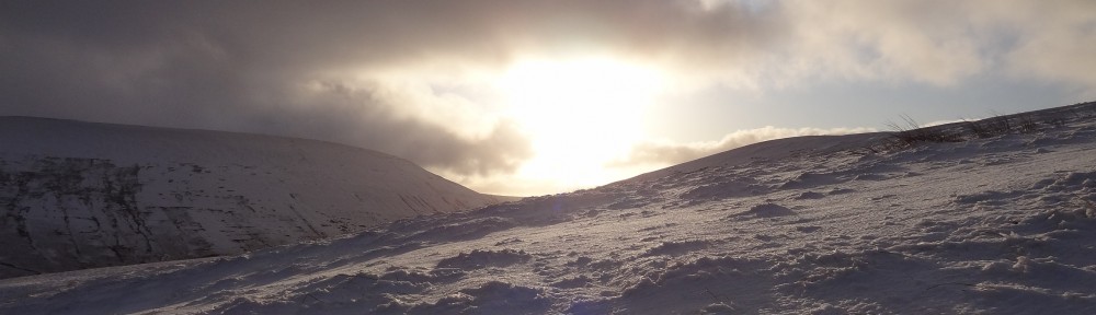
We took the mountain track up Ben Nevis, starting at the Nevis visitors centre. The weather was a bit wet when we started, and while we didn’t encounter any serious rain on the entire walk, there was a lot of snow and ice as we got nearer the top. Visibility was very poor and the cairns proved essential in finding our way once we were near the top.

The temperature up top was very very cold, it was quite windy which made things feel even chillier. We wore ski masks and by the time we begun our descent they had frozen up quite a bit, along with the rest our kit! We stopped for lunch in the shelter up top (which unfortunately was not left in a good state by other hikers).

We started walking at about 10.30 (after a brief visit to Fort William for supplies), and ended up finishing the walk in the dark at about 6pm (a head torch is essential).

Helvellyn

This was a short camping trip up in the lake district, pitching at Rydal Hall and ascending Helvellyn for a moderate hike. This is the route myself, Natalie, Paul, Kat, and Rob took:

Download file for GPS

The weather during the ascent was not great but improved dramatically after we reached the summit. By the time we got back to the car park it was glorious. This is myself and Natalie at the summit (conveniently hiding the summit marker, it is there honest!).

 This is the descent back to the car park, conditions were becoming much more pleasant.

The next picture was taken after the hike on our way into Ambleside for an evening out, as you can see the conditions were a complete contrast to the washout on arrival on Friday evening.

Tryfan

This was the first time I have ascended Tryfan, and it was very enjoyable indeed. As with Moel Siabod, the cloud base was quite low, restricting visibility and creating slippery conditions, but there was no rain this time! Almost as soon as we left the road we were into scrambling mode, and it didn’t take us long to reach “Adam and Eve” at the peak.

At a number is points I was painfully aware of how high up we were, and given the wet conditions I was quite nervous despite not normally having a problem with heights! Climbing onto Adam/Eve (not sure which one!) in the howling wind was an interesting experience, glad I did it but one mistake and it’s down the mountain you go!

After reaching the summit we continued on to the Glydders, down Devil’s Kitchen, and then finished off with a walk back to the car. As we were descending off the Glydders visibility improved dramatically, giving us some great views of the surrounding landscape. We also had to traverse a waterfall at one point, another moment where concentration is vitally important!

This is the route we took, you can clearly see in the altitude profile the ascent up Tryfan and the two Glydders.

Download file for GPS

Eventually we got a view of the surrounding valleys on our descent.

Once we’d got back to the campsite and cleaned up, it was off into Betws-y-coed for food and beer at The Royal Oak 🙂

Moel Siabod

The ascent of Moel Siabod was the first of two hikes myself and Paul did mid-March. We camped at Swallow Falls, near Betws-y-coed, and the second, more exciting hike/scramble will be the subject of my next post!

We chose Moel Siabod as it sounded a bit different to the usual peaks in Snowdonia, less well trodden but interesting none the less. The hike didn’t take us very long, and apart from some scrambling on the approach, it was a fairly easy walk. We were unlucky with the weather, a low cloud base and light rain reduced visibility, but this didn’t slow us down particularly.

Download file for GPS

Overall this was quite enjoyable, and a good warmup for the much longer route we took the following day.

Talybont-on-Usk

For this trip myself, Natalie, Paul, Kat, Boris, and Kat went to Talybont-on-Usk for the weekend, staying in a rather nice bed and breakfast called The Malt House. This place is highly recommended; the quality of the accommodation was very high, breakfast was fantastic, and the owners were very hospitable and helpful.

Shortly after we arrived on Friday evening we headed over to The White Hart pub to acclimatise ourselves. After a very nice meal we rounded off the evening with a six player game of Settlers of Catan.

Saturday saw us set out directly from Talybont-on-Usk, straight onto the hills and on up to Bryn. We took an early exit at this point due to poor weather conditions, if the weather had been better it’s not unreasonable to think we could have made it to Fan y Big and even Pen y Fan. This is the route we took:

Download file for GPS

We were out for about four hours in total, and after we got warm and dry again back at the B&B, we headed over to The Star Inn. This had a wood fire going, lots of real ales available, and was very comfortable. More board games and merriment followed 🙂

On Sunday we did the Henry Vaughan walk after breakfast (route below), which was quite enjoyable as the weather had improved considerably!

Download file for GPS

Brecon

So this was a couple of hikes in the Brecon beacons just before Christmas with Paul.

On Saturday we took a bit of an unconventional route starting early from the Storey Arms, heading up Fan Fawr, and then heading back to the start via a circuitous route taking bearings. The views were spectacular due to all the snowfall, and we experienced quite variable weather (the horizontal sleet biting into my cheeks was my favourite, hehe).

Sunday was another early start, this time we walked from Brecon up Pen-y-fan. This was quite a bit tougher then yesterday’s walk as we took the northern approach up to the summit; again there was considerable snowfall which made things very interesting! The final approach was pretty much a white out the whole way, and the ice axes actually came in useful for the last bit of scrambling 🙂 Lots of other hikers were out and even one or two people skiing.

Snowdon

So this time a larger group went on a hike up Mount Snowdon, not a terribly difficult walk but we were blessed in terms of the weather. The views were stunning and it was excellent fun! This is the merry band of hikers 🙂 (Paul had to miss this one due to work commitments unfortunately.)

As is compulsory, we rewarded out efforts with many beers back at the hostel (which conveniently was attached to a pub with a flexible definition of last orders!). My camera misted up on the way to the summit, hence this blur-o-vision shot of me at the top 🙂

Heptonstall Quarry

In April myself and Paul had a go at some top-roping in Heptonstall Quarry, West Yorkshire, with the help of his uncle Mick. We did a couple of short climbs each on some gritstone prior to reaching the quarry proper, these were pretty easy and served as practice using the gear (with Mick’s close supervision of course!).

Paul climbing, myself belaying

Once we moved into the quarry we set up the rope above the red wall and had a go at one of the cracks (Demera I think). It was fun laybacking but this was too hard too soon.

We reset the rope and had a go at the corner of the yellow wall (Trepidation I believe). This is about 24 metres high and quite straightforward, apart from one awkward bit where I needed to smear up the wall while holding on with only one hand so I could reach the next hold. This took quite a few attempts, and I think I would have given up if it wasn’t for the fact that the rope got stuck, meaning Paul couldn’t lower me down! So I had no choice but to push on, and I did it 🙂

Myself climbing, Paul belayingThis was the first time I’ve climbed on gritstone and was loads of fun, until next time!

Details of the routes are here.

Scafell Pike

Myself and some friends spent last Friday hiking in the Lake District, setting out from Seathwaite and ascending Scafell Pike (which is at an altitude of 978 metres). The walk took approximately 10.5 hours including some rest stops, and covered about 19 km. The last hour or so was done in the dark, which slowed us down somewhat towards the end. There was still quite a bit of snow left near the peak.

Weather-wise we did quite well, however it was very foggy so we didn’t get enjoy the spectacular views at the summit. On our descent to Wasdale Head we did get some decent views of Wast Water though.

The route was captured using Trails for iOS, which is a really polished app and very easy to use. The battery consumption was my main worry given that the app would be sampling our current location continuously, but my creaking iPhone 3G easily lasted the duration 🙂

This is the route in google maps, some segments weren’t accurately captured because the location couldn’t be determined, but overall it’s fairly representative.

Download file for GPS

And here are the chaps who I did the hike with 🙂

Pen y fan

This one was with Paul, Dave, and Boris, and not the most pleasant of hikes on account of the terrible weather. Beautiful Welsh valleys I’m sure were hiding behind the finest cloud I’ve ever seen…